AYLESBURY
- VERNEY JUNCTION (Pt.2)
(1868-1936)
The Metropolitan Railway's grandoise plans for a national
network stretching from Manchester to the European continent didn't
materialise (unfortunately, some may consider). The furthest north
they managed to get was Verney Junction, after taking
over the ailing Aylesbury & Buckingham Railway. Met Line services
on the line started in 1894 and continued until the Met
was incorportated into the London Transport Passenger Board, who
did not perceive the line as forming any part of its London
railway responsibilities and duly closed it (along with the Quainton
Road to Brill tramway branch).
The Aylesbury to Quainton Road section formed part
of the Great Central Railway's service from Marylebone and was
closed
to passengers in 1966 as part of Beeching's swingeing cutbacks.
There are enough relics of the line remaining to make
following its route an agreeable day out.
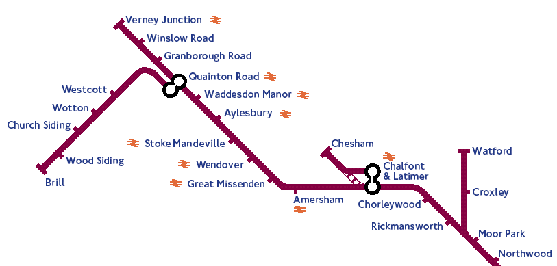
How the north-west corner of the tube map might look
today with the line open.
For a simulated journey along this line, as it was in 1900, the following YouTube videos are excellent:
Aylesbury to Quainton Road
Quainton Road to Verney Junction
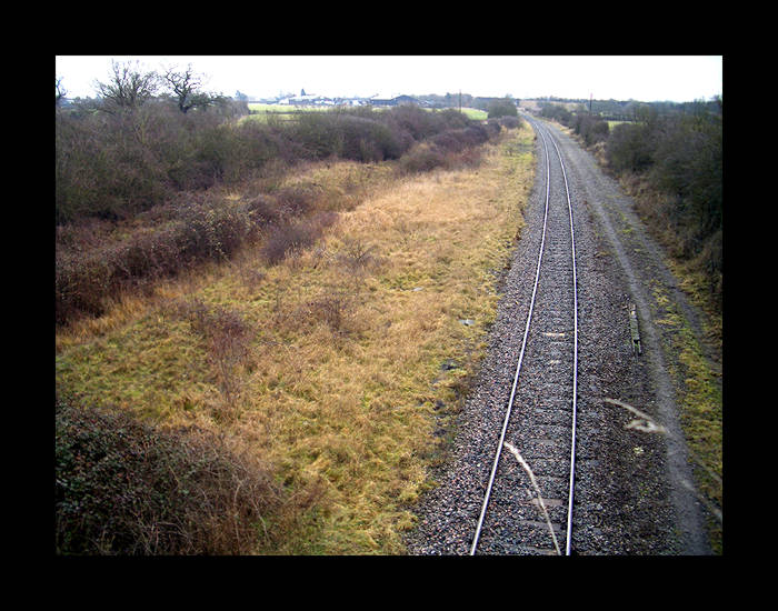
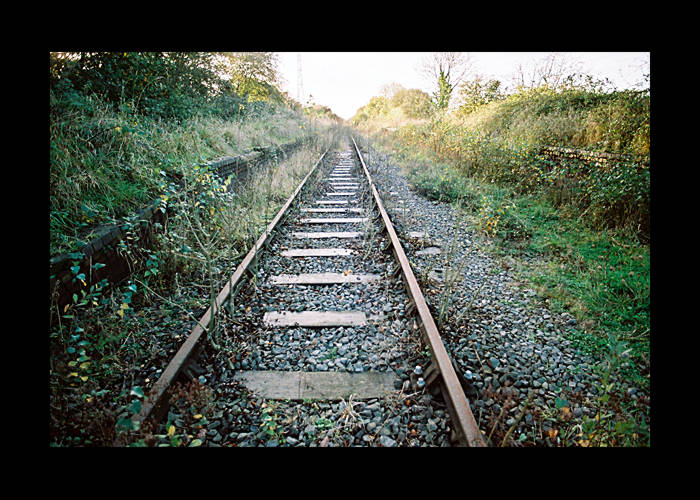
Trackbed north-west of Quainton Road station looking
back toward it.
This is point of the separation between the GCR and the Metropolitan
line. The Met line branch trackbed to Verney Junction
can be seen veering away to the left hand side.
(photo: 2005)
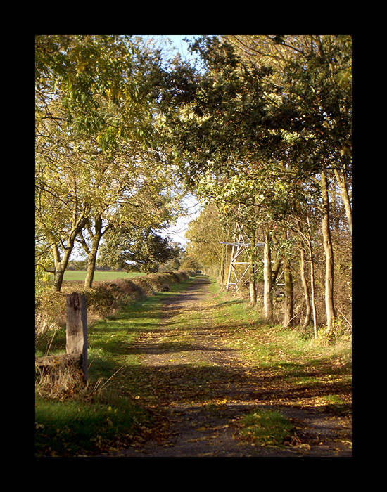
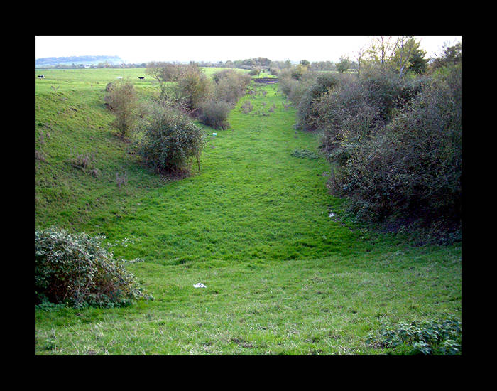 Trackbed north of Quainton Road station en route to
Verney Junction.
Trackbed north of Quainton Road station en route to
Verney Junction.
This view is looking southward from a bridge near Shipton Lee back toward Quainton Road - the
curve of the line taking it into
the junction with the GCR may just be seen in the distance.
(photo: 2005)
View northward from the same bridge near Shipton Lee, from the 1973 film Metro Land made by Sir John Betjeman
about the Metropolitan Railway.
GRANBOROUGH ROAD
 The remaining platform.
The helpful and informative farmer I met, remarked that the platform continued for a distance and
the
other end of it was visible on the other side of the hay stacks...
(photo: 2005)
 ...a clamber over which (ignoring the agrarian smells
and substances) did indeed
...a clamber over which (ignoring the agrarian smells
and substances) did indeed
reveal the distinctive blue bricks that the platforms on this
line were built with.
(photo: 2005)
Sadly, these remains seem to have removed sometime between 2018 and 2020, looking at the Google Street Maps view.
For more details and photos of this station, see www.disused-stations.org.uk
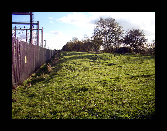 The embankment just south of Winslow Road station site,
looking south.
The embankment just south of Winslow Road station site,
looking south.
(photo: 2005)
WINSLOW ROAD
 The Station Kennels that utilise part of the station
platform and track area - the photograph was
The Station Kennels that utilise part of the station
platform and track area - the photograph was
taken from a point in line with the track on the site of the level
crossing.
(photo: 2005)
 Closer view of the platform area. The red brick structure
is built on the track area and part of the platform is visible
on the left of it.
Closer view of the platform area. The red brick structure
is built on the track area and part of the platform is visible
on the left of it.
Notice the blue railway bricks again.
(photo: 2005)
For more photos of this station, see www.disused-stations.org.uk
 Looking north at the trackbed opposite the Winslow
Road station site.
Looking north at the trackbed opposite the Winslow
Road station site.
(photo: 2005)
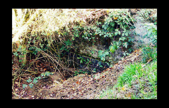
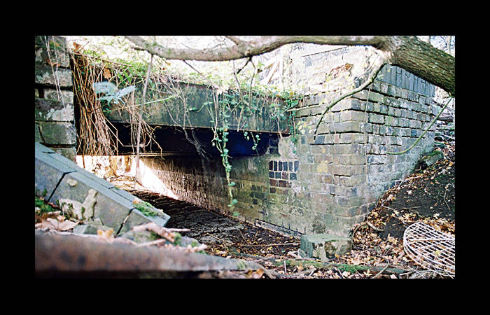 Small section of iron and brickwork remaining on the
trackbed, carrying the line over what would appear to be a small
dried out stream.
Small section of iron and brickwork remaining on the
trackbed, carrying the line over what would appear to be a small
dried out stream.
(photo: 2005)
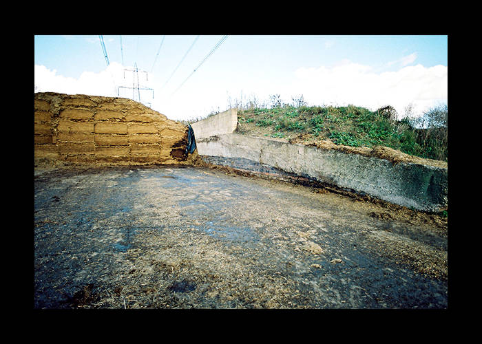
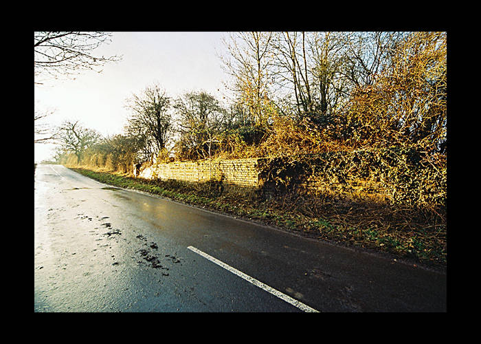 This is the brick base of the bridge that carried the
line over Verney Road and into Verney Junction station.
This is the brick base of the bridge that carried the
line over Verney Road and into Verney Junction station.
The road itself leads to the hamlet that is Verney Junction.
(photo: 2005)
VERNEY JUNCTION
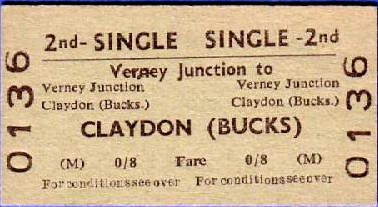
Verney Junction ticket as advertised on eBay in 2005.
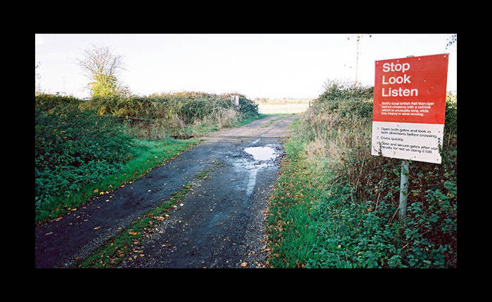 The level crossing on a minor road from the centre
of the hamlet of Verney Junction (opposite its pub).
The level crossing on a minor road from the centre
of the hamlet of Verney Junction (opposite its pub).
The impression that the station is in the middle of nowhere would
not be incorrect.
Bizarrely, an internet search for sites about this station in 2005 turned
up one website about the Verney Junction Swingers
Group which "...has more Verney Junction swingers registered
than any other UK swingers site" [sic].
So the area did seem at least to be the centre of something!
(photo: 2005)
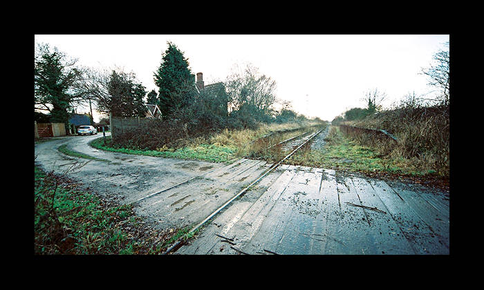
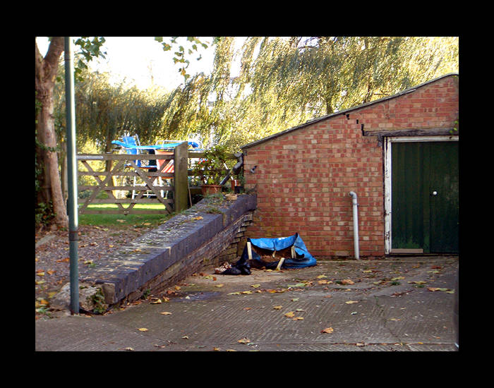
The level crossing. The station house is visible here.
This track area shown here belongs to the London & North Western
Railway - the Metropolian line from Quainton Road would
have terminated to the left of the left hand (island) platform.
The space for that track is now either severely overgrown, or
utilised for the extension of private gardens and new buildings.
All the platform remains shown in these photos were cleared in 2020 or so, as part of the works to reopen the line.
(photo: 2005)
 Opposite view from more or less the same position.
This is facing eastward - the new housing development seen here
encroaches on part of the Met line's former trackbed.
(photo: 2005)
 Westward view of the Metropolitan Line side - the platform
is still intact but the track
Westward view of the Metropolitan Line side - the platform
is still intact but the track
area (in this portion) is given to the garden of the station house.
(photo: 2005)
 Westward view of the London & North Western Railway
platforms and track bed. The left hand platform was the island
Westward view of the London & North Western Railway
platforms and track bed. The left hand platform was the island
platform shared with the Metropolitan line (out of shot on the
left hand side).
(photo: 2005)
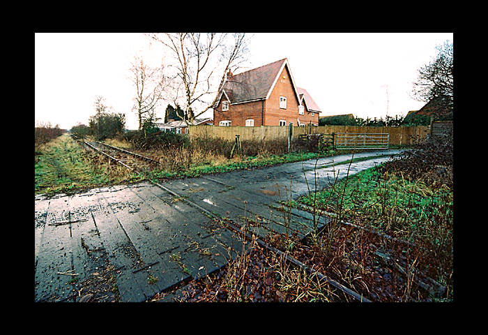
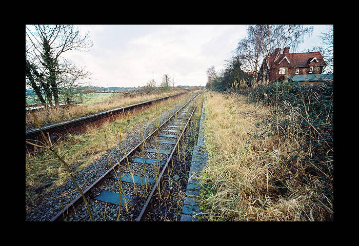 Eastern view with the station house on the right.
(photo: 2005)
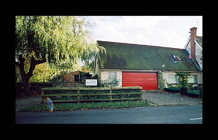
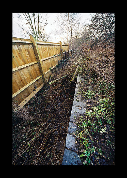
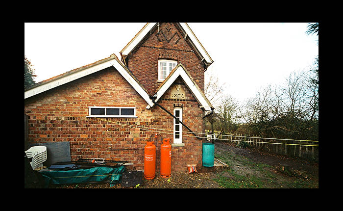 The station house, the current owner of which has a
very loud dog (probably to ward off all those swingers).
The area to the right of the house, now part of the
garden area of the house, is part of the Metropolitan line's station
platform trackbed.
The station house, the current owner of which has a
very loud dog (probably to ward off all those swingers).
The area to the right of the house, now part of the
garden area of the house, is part of the Metropolitan line's station
platform trackbed.
(photo: 2005)
(photo: 2005)
For more photos of this station, see www.disused-stations.org.uk
Reference:
Bill Simpson - "A History of the Metropolitan Railway. Volume
3: From Aylesbury north to Verney Junction and Brill"
(Lamplight Publications, Oxon 2005 - ISBN 1 899 246 13 4)
 Quainton Road - Brill line (Metropolitan Line)